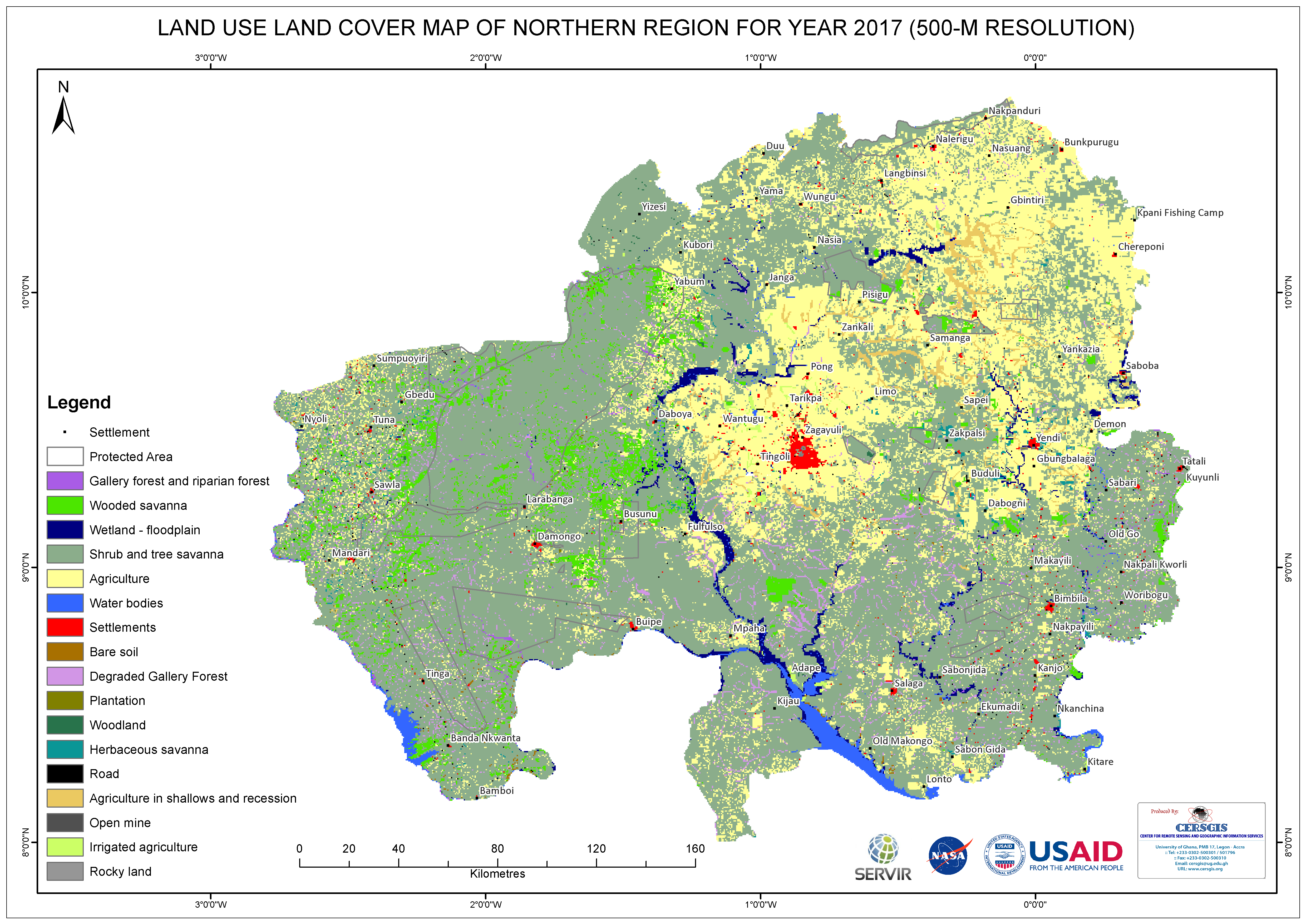
This map was created using Sentinel-2 imagery captured in October 2017. It provides a land use overview of the region at a 500m resolution. The Rapid Land Cover Mapper (RLCM) tool, accessible as an ArcGIS plug-in on the USGS website, was utilized to generate these visualizations.
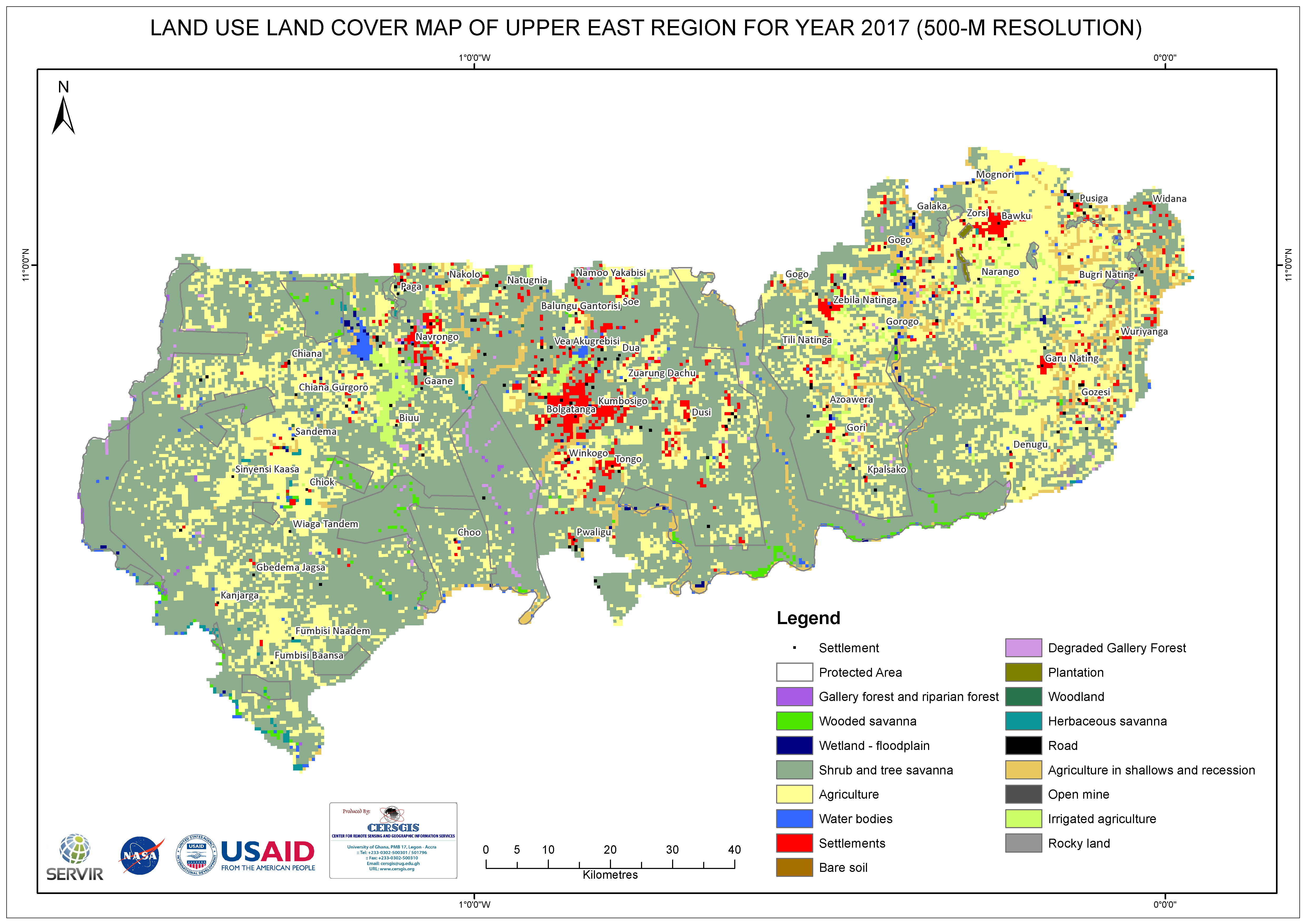
This map was developed using a sentinel 2 imagery for October 2017. It is a 500m resolution map that reveals the land use across the region. The Rapid Land Cover Mapper (RLCM) tool, available as an ArcGIS plug-in on the USGS website was used to generate these products.
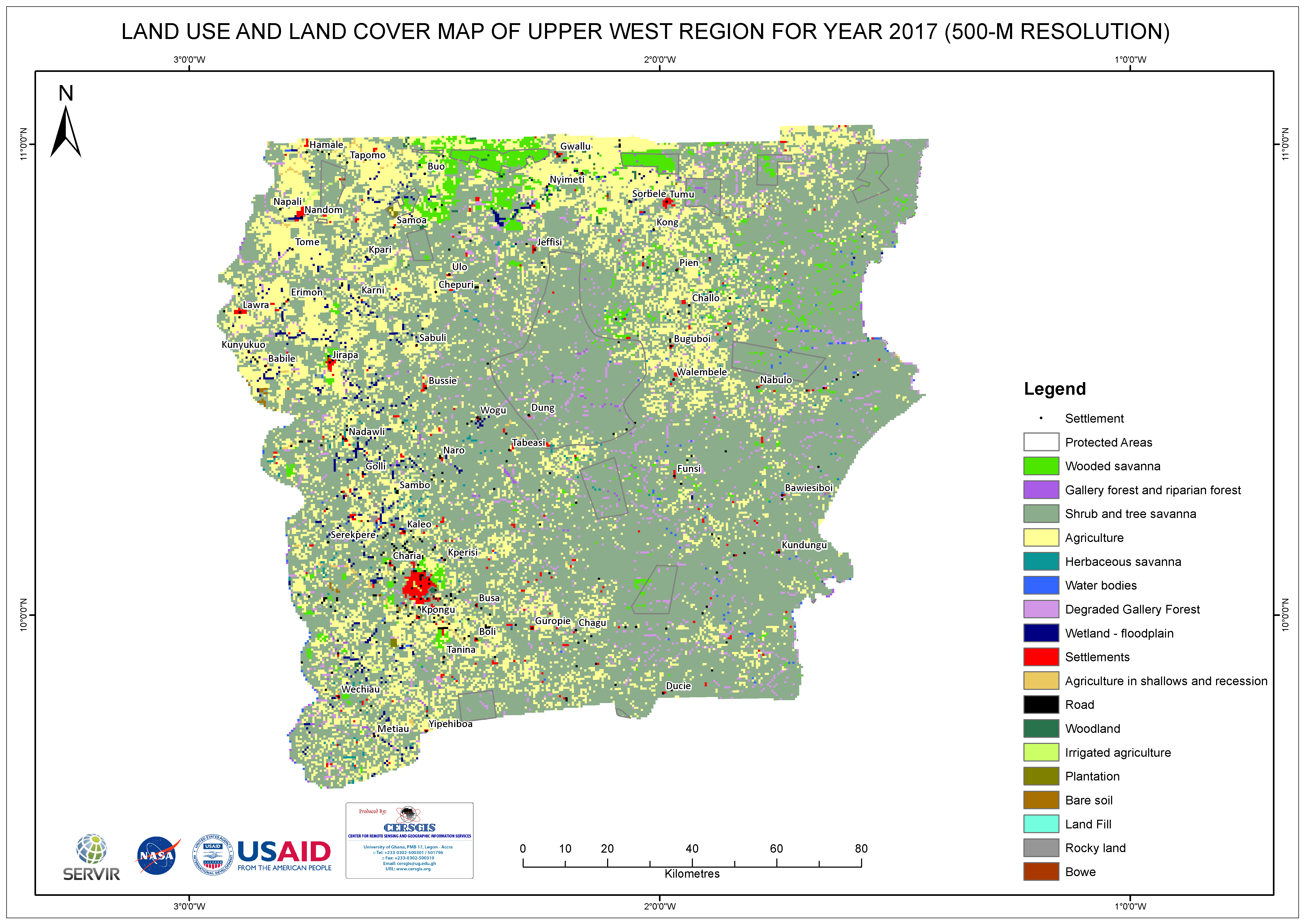
This map was developed using a sentinel 2 imagery for October 2017. It is a 500m resolution map that reveals the land use across the region. The Rapid Land Cover Mapper (RLCM) tool, available as an ArcGIS plug-in on the USGS website was used to generate these products.